
HOME
INTRO
SYMBOLS
ALMANAC
ECONOMY
GEOGRAPHY
STATE MAPS
PEOPLE
COUNTIES
GOVERNMENT
FORUM
NEWS
COOL SCHOOLS
STATE QUIZ
STATE LINKS
BOOK STORE
MARKETPLACE
NETSTATE.STORE
NETSTATE.MALL
GUESTBOOK
CONTACT US


Tweet
Double click on word for definition.
Blount County Location
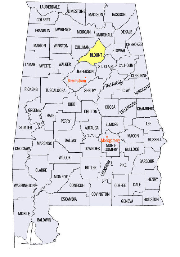
The map to the right shows the location of Blount County within the State of Alabama.
Blount County is located in northeastern Alabama (the mineral region) within the Cumberland Plateau physiographic region. Two major tributaries of the Black Warrior River run through the county. The Mulberry Fork runs along the western edge of the county. The Locust Fork runs through the center of the county.
Blount County was established by an Act of the Alabama territorial legislature on February 6,1818, almost two years before Alabama statehood.
The county was named for Tennessee Governor Willie Blount. He had sent Andrew Jackson to Alabama to aid settlers during the Creek War of 1813-14.
Oneonta, in the southeastern quadrant of the county, serves as the county seat of Blount County. It was named after Oneonta, New York.
Sources...
"Alabama Counties: Blount County." Alabama Department of Archives and History. State of Alabama, 31 Jan 2012. Web. 8 Jan 2014. <http://www.archives.state.al.us/counties/blount.html>.
Morton, Patricia Hoskins. "Alabama Counties: Blount County." Encyclopedia of Alabama. Alabama Humanities Foundation, 26 Mar 2013. Web. 8 Jan 2014. <http://www.encyclopediaofalabama.org/face/Article.jsp?id=h-1209>.
"State & County QuickFacts." United States Census Bureau. United States Department of Commerce. Web. 3 Jan 2014.
Additional Information
Major roads and towns
Blount County Map

Blount County history page: Alabama Department of Archives and History.
Blount County: The Encyclopedia of Alabama TM & © 2013. Alabama Humanities Foundation. All Rights Reserved. A service of Auburn University, The University of Alabama, and Alabama State Dept. of Education.
Map: Autauga County's major roads and towns.:
Prepared by the Department of Geography, College of Arts and Sciences, The University of Alabama.
View Larger Map
General Highway Map: Autauga County, Alabama:
Prepared by the Alabama Department of Transportation, Bureau of Transportation Planning, Surveying and Mapping Division in cooperation with the U.S. Department of Transportation.
Autauga County, Alabama Genealogical Information: The USGenWeb Project: Keeping Internet Genealogy Free.
Autauga County, Alabama: United States Census Bureau: State & County QuickFacts.
Blount County, Alabama: Official website of Blount County, Alabama.
Blount County Historic Trust: Official website.
Blount County Historical Museum: Official website.
Oneonta: The Encyclopedia of Alabama TM & © 2013. Alabama Humanities Foundation. All Rights Reserved. A service of Auburn University, The University of Alabama, and Alabama State Dept. of Education.
Oneonta, Alabama: Official Site of the City of Oneonta, a small city with big ideas.
Alabama County Web Sites: State of Alabama: Alabama Directory.
Alabama County Selection Map: United States Census Bureau: State & County QuickFacts.
Alabama County Map with County Seat Cities: Geology.com.
Maps of Alabama Counties: University of Alabama: Alabama Maps.
Alabama Counties from Amazon.com
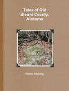
Tales of Old
Blount County, Alabama
Robin Sterling
Tales of Old Blount County, Alabama, by Robin Sterling. 390 pages. Publisher: PUBLISHERDATE Reading level: Grades 99. DESCRIPTION.
This book of essays is an attempt to revisit some of the well known events of our county’s past, add a little more background, and present our history from a Blount County point of view.
In addition to illuminating some familiar topics, this book attempts to bring to light people and events who played significant roles in the development of Blount, but were somehow overlooked or skimmed over by the primary reference books—people and events which were the topic of conversation among our ancestors but over time, have been forgotten.
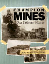
Champion Mines
Aulden Woodard
Van Gunter
Champion Mines: Our Fathers' Mines, by Aulden Woodard and Van Gunter. 216 pages. Publisher: Fifth Estate, Incorporated (October 25, 2011)
The regional history of Alabama's mines and the families that worked the mines are presented here in a compilation of information and stories about the lives and times of the miners of Champion and Tait's Gap mines and their families. It tells the history of Champion, a mining camp community in Blount County, near Oneonta, Alabama, and the lives and times of its miners and their families.
The story of Champion is told from the point of view of the book’s two contributors. Woodard provides a portrait of the camps and the people and a glimpse of the daily lives of a number of the camps’ inhabitants, as well as a perspective on growing up there. Gunter emphasizes the development of the industry and technical aspects of ore mining with a fascinating glimpse of a mine superintendent.
A third section of the book, compiled by curator Amy Rhudy from museum files and records, is a collection of newspaper clippings, photos, and other memorabilia documenting the place in local life of the mining camp and the iron industry.
The mine closed for the final time in 1968, having produced an estimated 2.4 million tons over its 79-year lifespan.


