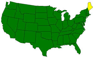
The Geography of Maine
Click here for a few definitions.
| Longitude / Latitude |
Longitude: 66° 57'W to 71° 7'W
Latitude: 43° 4'N to 47° 28'N |
|
| Length x Width |
Maine is about 320 miles long and 190 miles wide. |
|
Geographic Center
Explanation |
The
geographic center
of Maine is located in Piscataquis county, 18 miles north of Dover-Foxcroft.
Longitude: 69° 14.0'W
Latitude: 45° 15.2'N |
|
| Borders |
Maine is bordered on the north by Canada and on the south and
west by New Hampshire. To the east of Maine lies the
Atlantic Ocean. |
| Total Area |
Maine covers 35,387 square miles, making it the 39th largest of the
50 states. |
| Land Area |
30,865 square miles of Maine are land areas. |
| Water Area |
4,523 square miles of Maine are covered by water. |
| Highest Point |
The highest point in Maine is
Mount Katahdin
at 5,276 feet above sea level. Mount Katahdin is located in
Baxter State Park. |
| Lowest Point |
The lowest point in Maine is sea level where at the Atlantic Ocean. |
| Mean Elevation |
The Mean Elevation of the state of Maine is 600 feet above sea level. |
| Major Rivers |
Androscoggin River, Kennebec River, Penobscot River, St. John River |
| Major Lakes |
Moosehead Lake, Richardson Lake |
The Land |
| Located in the far northeast corner of the United States, Maine is the largest of the New England states.
The Maine penninsula, West Quoddy Head, is the easternmost land area of the United States. The Pine Tree
State (Almost 90% of Maine is forested.) can be divided into three geographic land areas stretching from the
Atlantic Ocean in the east, northwest to the White Mountains.
Coastal Lowlands: The Coastal Lowlands start at the Atlantic Ocean and extend from ten to forty
miles inland. This area is characterized by flat, sandy beaches in the south and small sandy beaches in
small inlets between higher cliffs in the north. Thousands of years ago, this land was much higher. During
the ice-age the land was compacted however, pushing the land down so that only the tops of hills remained
above water. These hilltops form over 400 islands off the coast of Maine. Mt. Desert is the largest of
these islands and is the base for Cadillac Mountain, rising 1,530 feet above sea level. To the west of
the coast and the beaches, the Coastal Lowlands are characterized by salt marshes and tidal creeks.
Eastern New England Uplands: To the northwest of the Coastal Lowlands, is a section of the Eastern
New England Uplands that stretch from Canada south to Connecticut. This section is about twenty to fifty
miles wide and rises from sea level to about 2,000 feet in the west. In the northern portion of the New
England Uplands lies the Aroostook Plateau. This good farmland and is where Maine Potato crops prosper,
growing strong in the deep fertile soil. South of the Aroostook Plateau, the land is marked by lakes and
fast streams. The Longfellow Mountains run through the center of the the New England Uplands.
White Mountains: An extension of New Hampshire's White Mountains, the Maine White Mountain region
covers northwestern Maine; about 5 miles wide in the north and about 30 miles wide in the south.
Mount Katahdin,
Maine's highest point, is found in this region along with 9 other mountains over 4,000 feet high,
and 97 mountains over 3,000 feet high.
( Maine Close-up ) |
| Climate (All temperatures Fahrenheit) |
| Highest Temperature |
The highest temperature recorded in Maine is 105°, Fahrenheit. This record high
was recorded on July 10, 1911 at North Bridgton. |
| Lowest Temperature |
The lowest temperature in Maine, -48°, was recorded on January 19, 1925 at Van Buren. |
| Average Temperature |
Monthly average temperatures range from a high of 78.9 degrees to a low of 11.9 degrees. |
| Climate |
Average yearly precipitation for Maine, from 1971 to 2000, is shown on
this chart from Oregon State University. |
|