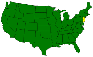
| New Jersey is either the 4th smallest state or the 47th largest state depending
on your perspective. Regardless, New Jersey is occupied by 4 main land regions;
the Atlantic Coastal Plain, the Piedmont, the New England Upland, and the Appalachian
Ridge and Valley Region.
The largest land area, the Atlantic Coastal Plain, covers the southern 3/5
of New Jersey. More than half of this area, characterized by gently rolling hills,
is less than 100 feet above sea level. In the east the landscape consists of
pine forests and salt marshes. Closer to the Atlantic coast, the salt marshes
are more plentiful and shallow lagoons and meadows characterize the area. Along
the coast lie New Jersey's resort areas; including Atlantic City, Ocean City, and
Cape May. In the west and southwest, along the Delaware River, the fertile soil
supports farming.
The Piedmont lies northeast of the Atlantic Coastal Plain. About 20 miles
wide, this area covers only about 1/5 of the state. The Piedmont includes the
industrial cities of Elizabeth, Patterson, Jersey City, and Newark. New Jersey's
major rivers (Hudson River, Passaic River, Remapo River, Raritan River) are found
in this area supporting the industrial development.
West of the Peidmont is the New England Upland. This area, sometimes called
The Highlands, includes flat-topped ridges of rock and extends into Pennsylvania
and New York. This area is characterized by the many beautiful lakes nestled among
the ridges.
In the northwest corner of the state is the Appalachian Ridge and Valley Region.
This mountainous area includes the Kittatinny Mountains that run parallel to New Jersey's northwestern
border. The Delaware Water Gap is where the Delaware River has cut through the Kittatinny Mountains.
The wide Appalachian Valley lies southeast of the Kittatinny Mountains. Shale and limestone formation can
be found in the valley along with dairy cattle and apple orchards.
( New Jersey Close-up ) |


