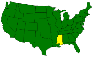
The Geography of Mississippi
Click here for a few definitions.
| Longitude / Latitude |
Longitude: 88° 7' W to 91° 41' W
Latitude: 30° 13' N to 35° N |
|
| Length x Width |
Mississippi is 340 miles long and 170 miles wide. |
|
Geographic Center
Explanation |
The
geographic center
of Mississippi is located in Leake County, 9 miles WNW of Carthage.
Longitude: 89° 43.0'W
Latitude: 32° 48.9'N |
|
| Borders |
Mississippi is bordered by Tennessee on the north and the Gulf of
Mexico on the south. On the east, Mississippi borders
Alabama and on the west, Mississippi borders
Arkansas and Louisiana. |
| Total Area |
Mississippi covers 48, 434 square miles, making it the 32nd largest of the
50 states. |
| Land Area |
46,914 square miles of Mississippi are land areas. |
| Water Area |
1,520 square miles of Mississippi are covered by water. |
| Highest Point |
The highest point in Mississippi is Woodall Mountain. Hardly
a mountain, Woodall Mountain is only 806 feet above sea level. |
| Lowest Point |
The lowest point in Mississippi is along the shore at the Gulf
of Mexico; sea level. |
| Mean Elevation |
The Mean Elevation of the state of Mississippi is 300 feet above sea level. |
| Major Rivers |
Mississippi River,
Big Black River, Pearl River, Yazoo River |
| Major Lakes |
Ross Barnett Reservoir, Arkabutla Lake, Sardis Lake, Grenada Lake |
The Land |
| Low fertile delta between the Yazoo and Mississippi Rivers. Loess
(buff to yellowish brown loamy deposits left by the wind) bluffs
stretch around the delta border followed sandy Gulf coastal terraces, piney woods,
and prairie. High sandy hills in the northeast and black prairie belt, Pontotoc Ridge,
and flatlands turning north to central highlands.
( Mississippi Close-up ) |
| Climate (All temperatures Fahrenheit) |
| Highest Temperature |
The highest temperature recorded in Mississippi is 115°, Fahrenheit. This record high
was recorded on July 29, 1930 at Holly Springs. |
| Lowest Temperature |
The lowest temperature in Mississippi, -19°, was recorded on January 30, 1966
at Corinth. |
| Average Temperature |
Monthly average temperatures range from a high of 92.5 degrees to a low of 34.9 degrees. |
| Climate |
Average yearly precipitation for Mississippi, from 1971 to 2000, is shown on
this chart from Oregon State University. |
|
Sources:
The World Almanac of the U.S.A.
by Allan Carpenter and Carl Provorse, Copyright © 1998
John Ray Skates, Jr. and Robert W. Wales, "Mississippi," World Book Online Americas Edition,
http://www.worldbookonline.com/wbol/wbPage/na/ar/co/364600,
August 15, 2001.
The United States Geological Survey Website
Maps.com http://www.maps.com
 |
|