
HOME
INTRO
SYMBOLS
ALMANAC
ECONOMY
GEOGRAPHY
STATE MAPS
PEOPLE
COUNTIES
GOVERNMENT
FORUM
NEWS
COOL SCHOOLS
STATE QUIZ
STATE LINKS
BOOK STORE
MARKETPLACE
NETSTATE.STORE
NETSTATE.MALL
GUESTBOOK
CONTACT US


Tweet
Double click on word for definition.
Barbour County Location
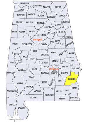
The map to the right shows the location of Barbour County within the State of Alabama.
Barbour County is located in southeastern Alabama within the East Gulf Coastal Plain physiographic region. The eastern edge of the county is bordered by the Chattahoochee River and the State of Georgia.
Barbour County was established on December 18, 1832. It was created from land ceded by the Creek Indians in the 1814 Treaty of Fort Jackson and part of Pike County.
The county was named for distinguished statesman and orator James Barbour. A lawyer by trade, Barbour served in the Virginia House of Delegates, as Governor of Virginia, as a U.S. Senator and President John Quincy Adams' Secretary of War.
Louisville, the former county seat of Pike County, served as Barbour County's seat in 1833. In 1834, however, an 11-member commission selected the more centrally site for the town of Clayton as the county seat. Today, Clayton, in the west central part of the county, serves as the county seat of Barbour County.
However, in the 1870s, amid discussion about moving the county seat from centrally located Clayton to the more prosperous and populous Eufaula, on the Chattahoochee River, Act No. 106 of February 12, 1879 established courts in both Eufaula and Clayton: a unique arrangement. The court in Clayton handles criminal and civil matters in the western part of the county and the court in Eufaula handles criminal and civil matters in the eastern part of the county.
At a glance
| Point | Fact |
|---|---|
| Established: | December 18, 1832 |
| Source: | Created from land ceded by Creek Indians in the 1814 Treaty of Fort Jackson and part of Pike County. |
| Area (square miles): | 884 |
| Population (2010 census): | 27,457 |
| Major waterway(s): | The Chattahoochee River runs along the eastern edge of Barbour County, part of a border between Alabama and Georgia. The Choctawhatchee River originates near the center of Barbour County and runs south, about 140 miles, through the Florida panhandle, emptying into Choctawhatchee Bay. |
| Major highway(s): | U.S. Route 82 runs diagonally, northwest to southeast to Eufaula, in the northeast part of the county. U.S. Route 431 runs north to south on the eastern edge of the county, roughly following the Chattahoochee River. |
| County seat: | Clanton |
| Largest city: | Eufaula |
Sources...
"Alabama Counties: Barbour County." Alabama Department of Archives and History. State of Alabama, 13 Dec 2011. Web. 6 Jan 2014. <http://www.archives.state.al.us/counties/barbour.html>.
Siebenthaler, Donna J. "Alabama Counties: Barbour County." Encyclopedia of Alabama. Alabama Humanities Foundation, 13 Jun 2013. Web. 6 Jan 2014. <http://www.encyclopediaofalabama.org/face/Article.jsp?id=h-1195>.
"State & County QuickFacts." United States Census Bureau. United States Department of Commerce. Web. 3 Jan 2014.
Additional Information
View Larger Map
Barbour County history page: Alabama Department of Archives and History.
Barbour County: The Encyclopedia of Alabama TM & © 2013. Alabama Humanities Foundation. All Rights Reserved. A service of Auburn University, The University of Alabama, and Alabama State Dept. of Education.
Map: Barbour County's major roads and towns. :
Prepared by the Department of Geography, College of Arts and Sciences, The University of Alabama.
:
Prepared by the Department of Geography, College of Arts and Sciences, The University of Alabama.
Barbour County: Major roads and towns:
Cartographic Research Lab, University of Alabama.
General Highway Map: Barbour County, Alabama:
Prepared by the Alabama Department of Transportation, Bureau of Transportation Planning, Surveying and Mapping Division in cooperation with the U.S. Department of Transportation.
Barbour County, Alabama Genealogical Information:
The USGenWeb Project: Keeping Internet Genealogy Free.
Barbour County, Alabama: United States Census Bureau: State & County QuickFacts.
Barbour County: National Association of Counties (NACO).
Barbour County Contact Information: from the State of Alabama.
Clayton: The Encyclopedia of Alabama TM & © 2013. Alabama Humanities Foundation. All Rights Reserved. A service of Auburn University, The University of Alabama, and Alabama State Dept. of Education.
Clayton, Alabama: Description from Wikipedia, the free encyclopedia.
The Clayton Record: Barbour County's only home-owned newspaper, covering Barbour County from the county seat.
Backtracking in
Barbour County
Anne Kendrick Walker
Alabama County Web Sites: State of Alabama: Alabama Directory.
Alabama County Selection Map: United States Census Bureau: State & County QuickFacts.
Alabama County Map with County Seat Cities: Geology.com.
Maps of Alabama Counties: University of Alabama: Alabama Maps.
Alabama Counties from Amazon.com
Backtracking in Barbour County: A Narrative of the Last Alabama Frontier, by Anne Kendrick Walker. 353 pages. Publisher: The Dietz Press (1941)


