
HOME
INTRO
SYMBOLS
ALMANAC
ECONOMY
GEOGRAPHY
STATE MAPS
PEOPLE
COUNTIES
GOVERNMENT
FORUM
NEWS
COOL SCHOOLS
STATE QUIZ
STATE LINKS
BOOK STORE
MARKETPLACE
NETSTATE.STORE
NETSTATE.MALL
GUESTBOOK
CONTACT US


Tweet
Double click on word for definition.
Butler County Location
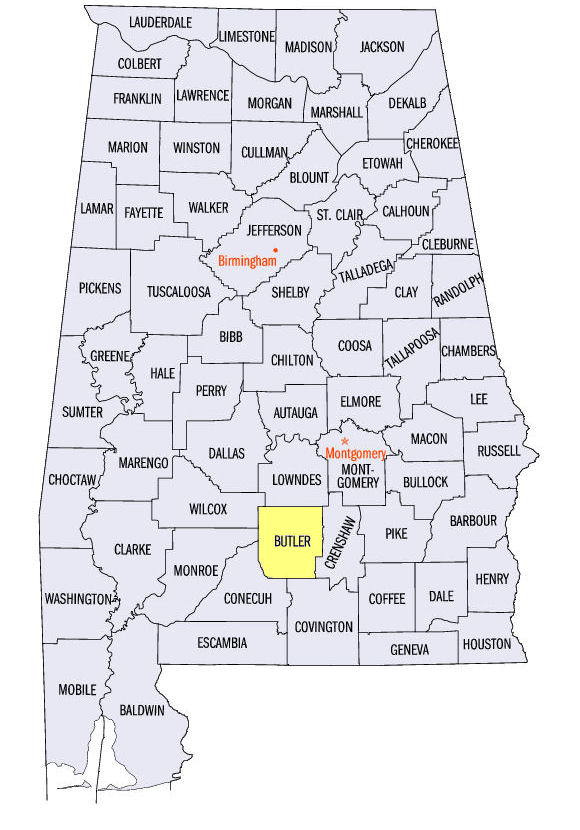
The map to the right shows the location of Butler County, located in south central Alabama within the East Gulf Coastal Plain physiographic region. Wolf Creek, tributary of the Alabama River runs through the northwestern corner of the county. Panther, Persimmon, and Pigeon Creeks, tributaries of the Conecuh River, run through the southern section of the county.
Butler County was established by an Act of the first session of the Alabama legislature on December 13, 1819.
The county was named for Capt. William Butler, soldier in the 1813-1814 Creek War.
Greenville, in the north central area of the county, serves as Butler's county seat.
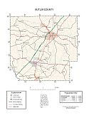
Major roads and towns
Butler County Map

Sources...
"Alabama Counties: Butler County." Alabama Department of Archives and History. State of Alabama, 14 Dec 2011. Web. 10 Jan 2014. <http://www.archives.state.al.us/counties/butler.html>.
"Alabama Counties: Butler County." Encyclopedia of Alabama. Alabama Humanities Foundation, 22 Mar 2013. Web. 5 Jan 2014. <http://www.encyclopediaofalabama.org/face/Article.jsp?id=h-1073>.
"State & County QuickFacts." United States Census Bureau. United States Department of Commerce. Web. 3 Jan 2014.
Additional Information
View Larger Map
Butler County history page: Alabama Department of Archives and History.
Butler County: The Encyclopedia of Alabama TM & © 2013. Alabama Humanities Foundation. All Rights Reserved. A service of Auburn University, The University of Alabama, and Alabama State Dept. of Education.
Map: Butler County's major roads and towns.:
Prepared by the Department of Geography, College of Arts and Sciences, The University of Alabama.
General Highway Map: Butler County, Alabama:
Prepared by the Alabama Department of Transportation, Bureau of Transportation Planning, Surveying and Mapping Division in cooperation with the U.S. Department of Transportation.
Autauga County, Alabama Genealogical Information: The USGenWeb Project: Keeping Internet Genealogy Free.
Autauga County, Alabama: United States Census Bureau: State & County QuickFacts.
Autauga County: Home: Official website of Autauga County, Alabama.
Greenville: The Encyclopedia of Alabama TM & © 2013. Alabama Humanities Foundation. All Rights Reserved. A service of Auburn University, The University of Alabama, and Alabama State Dept. of Education.
Prattville, Alabama: Official Site of the City of Prattville.
Alabama County Web Sites: State of Alabama: Alabama Directory.
Alabama County Selection Map: United States Census Bureau: State & County QuickFacts.
Alabama County Map with County Seat Cities: Geology.com.
Maps of Alabama Counties: University of Alabama: Alabama Maps.
Alabama Counties from Amazon.com

The History of
Butler County, Alabama,
from 1815 to 1885
John Buckner Little
The history of Butler County, Alabama, from 1815 to 1885, by John Buckner Little. 294 pages. Publisher: Dunks Institute for Genealogial and Historic Research (2012) Originally published by Elm Street Printing Co. (1885)
With sketches of some of her most distinguished citizens and glances at her rich and varied resources.

A Pictorial History
of Butler County
Greenville Advocate
A Pictorial History of Butler County, Alabama, The Greenville Advocate. 99 pages. Publisher: Pediment Publishing; 1ST edition (1999)
Well over 200 vintage photographs depict the people and places of Butler from the mid-19th through the early 20th centuries. Each photo is captioned, and there are other historical notes throughout.


