
HOME
INTRO
SYMBOLS
ALMANAC
ECONOMY
GEOGRAPHY
STATE MAPS
PEOPLE
COUNTIES
GOVERNMENT
FORUM
NEWS
COOL SCHOOLS
STATE QUIZ
STATE LINKS
BOOK STORE
MARKETPLACE
NETSTATE.STORE
NETSTATE.MALL
GUESTBOOK
CONTACT US


Tweet
Double click on word for definition.
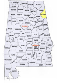
Cherokee County Location
View Larger Map
The map to the right shows the location of Cherokee County within the State of Alabama.
Cherokee County is located in northeastern Alabama within the Alabama Valley and Ridge physiographic region. Its eastern border is with the State of Georgia.
Cherokee County was established by an Act of the Alabama Legislature on December 9, 1836.
The county was named for the Cherokee Indian tribe who ceded the land to the Federal government in 1835.
The county seat of Cherokee County was first established in Cedar Bluff, on the north shore of Weiss Lake in 1837. It was relocated to the more centrally located town of Centre in 1844.
University of Alabama
Cartographic Research Lab
Major roads and towns
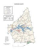
Cherokee County Map

Sources...
"Alabama Counties: Cherokee County." Alabama Department of Archives and History. State of Alabama, 13 Jun 2011. Web. 16 Jan 2014. <http://www.archives.state.al.us/counties/cherokee.html>.
Morton, Patricia Hoskins. "Alabama Counties: Cherokee County." Encyclopedia of Alabama. Alabama Humanities Foundation, 22 Mar 2013. Web. 16 Jan 2014. <http://www.encyclopediaofalabama.org/face/Article.jsp?id=h-1306>.
"State & County QuickFacts." United States Census Bureau. United States Department of Commerce. Web. 3 Jan 2014.
Additional Information
Cherokee County history page: Alabama Department of Archives and History.
Cherokee County: The Encyclopedia of Alabama TM & © 2013. Alabama Humanities Foundation. All Rights Reserved. A service of Auburn University, The University of Alabama, and Alabama State Dept. of Education.
Map: Cherokee County's major roads and towns.:
Prepared by the Department of Geography, College of Arts and Sciences, The University of Alabama.
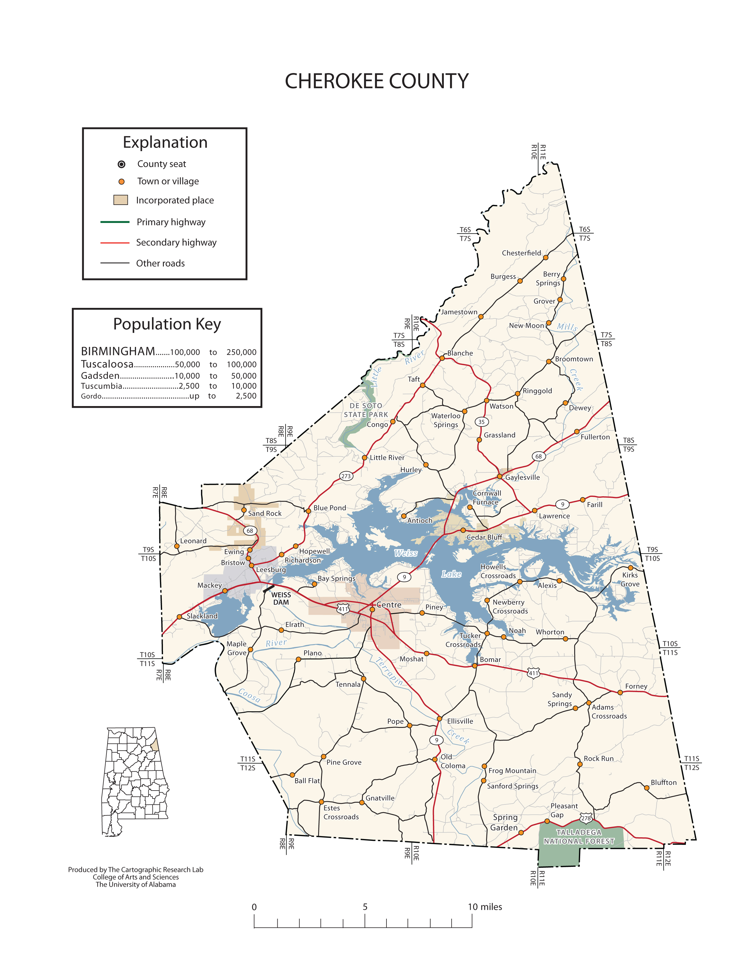
General Highway Map: Cherokee County, Alabama:
Prepared by the Alabama Department of Transportation, Bureau of Transportation Planning, Surveying and Mapping Division in cooperation with the U.S. Department of Transportation.
Cherokee County, Alabama Genealogical Information: The USGenWeb Project: Keeping Internet Genealogy Free.
Cherokee County, Alabama: United States Census Bureau: State & County QuickFacts.
Cherokee County Commission: Official website of Cherokee County Commission, Alabama.
Centre: The Encyclopedia of Alabama TM & © 2013. Alabama Humanities Foundation. All Rights Reserved. A service of Auburn University, The University of Alabama, and Alabama State Dept. of Education.
City of Centre, Alabama: Official Site of the City of Centre, "Crappie Capital of the World."
Alabama County Web Sites: State of Alabama: Alabama Directory.
Alabama County Selection Map: United States Census Bureau: State & County QuickFacts.
Alabama County Map with County Seat Cities: Geology.com.
Maps of Alabama Counties: University of Alabama: Alabama Maps.
Alabama Counties from Amazon.com
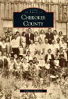
Images of America:
Cherokee County
Bobby G. McElwee
Images of America: Cherokee County, by Bobby G. McElwee. 128 pages. Publisher: Arcadia Publishing (August 2, 2000)
Created in 1836 from land held formerly by the Cherokee Indians, Cherokee County is situated in the northeast corner of Alabama, bordered by Georgia to the east. Within these pages, the county’s rich and varied history is illuminated by vintage photographs, and its past is brought to life in the faces of its early settlers. The families of the Reverend Whitefield Anthony and others settled at Mudd Creek in 1831 in what was to become Cherokee County. From these first families developed a community that would grow and change along with a young and bustling America, welcoming new industries, farming fertile lands, and building churches and schools to feed the hearts and minds of its young. The photographs in this volume, illustrating the county’s past as well as how it looks in the present day, were culled from a variety of sources, including the Cherokee County History Museum, the Pine Grove Baptist Church, and the private collections of many local families. Coupled with a historical narrative, these glimpses of yesteryear will evoke fond memories for all who have made Cherokee County home.


