
HOME
INTRO
SYMBOLS
ALMANAC
ECONOMY
GEOGRAPHY
STATE MAPS
PEOPLE
COUNTIES
GOVERNMENT
FORUM
NEWS
COOL SCHOOLS
STATE QUIZ
STATE LINKS
BOOK STORE
MARKETPLACE
NETSTATE.STORE
NETSTATE.MALL
GUESTBOOK
CONTACT US


Tweet
Double click on word for definition.
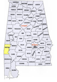
Choctaw County Location
View Larger Map
The map to the right shows the location of Choctaw County within the State of Alabama.
Choctaw County is located in southwestern Alabama within the East Gulf Coastal Plain physiographic region. On the west, it borders the State of Mississippi. The Tombigbee River runs along the eastern edge of the county.
Choctaw County was established by an Act of the Alabama Legislature on December 29, 1847 from land formerly belonging to the Choctaw Indian nation.
The county was named for the Choctaw Indians.
Barrytown, located in the southern part of the county, was the first county seat of Choctaw County. In 1848, the Alabama Legislature authorized a move to Butler, a more central location within the county. Butler is located in the north central portion of the county and currently serves as the county seat of Choctaw County. It was named for South Carolinian, Col. Pierce Butler, who was killed in the Mexican-American War.
University of Alabama
Cartographic Research Lab
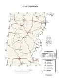
Major roads and towns
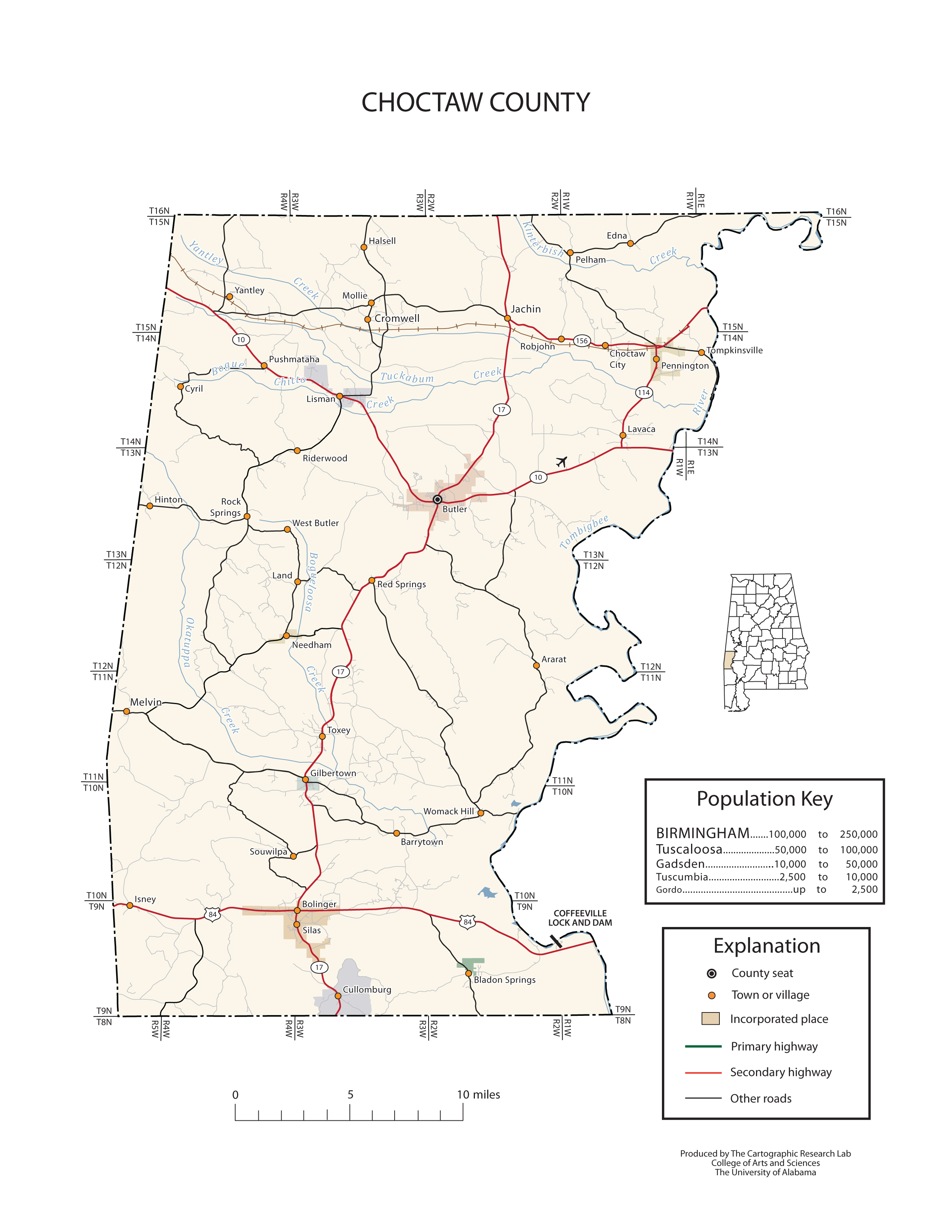
Choctaw County Map

Sources...
"Alabama Counties: Choctaw County." Alabama Department of Archives and History. State of Alabama, 25 Oct 2011. Web. 18 Jan 2014. <http://www.archives.state.al.us/counties/choctaw.html>.
Morton, Patricia Hoskins. "Alabama Counties: Choctaw County." Encyclopedia of Alabama. Alabama Humanities Foundation, 3 Jul 2013. Web. 18 Jan 2014. <http://www.encyclopediaofalabama.org/face/Article.jsp?id=h-1073>.
"State & County QuickFacts." United States Census Bureau. United States Department of Commerce. Web. 3 Jan 2014.
Additional Information
Choctaw County history page: Alabama Department of Archives and History.
Choctaw County: The Encyclopedia of Alabama TM & © 2013. Alabama Humanities Foundation. All Rights Reserved. A service of Auburn University, The University of Alabama, and Alabama State Dept. of Education.
Map: Choctaw County's major roads and towns.:
Prepared by the Department of Geography, College of Arts and Sciences, The University of Alabama.
General Highway Map: Autauga County, Alabama:
Prepared by the Alabama Department of Transportation, Bureau of Transportation Planning, Surveying and Mapping Division in cooperation with the U.S. Department of Transportation.
Choctaw County, Alabama Genealogical Information: The USGenWeb Project: Keeping Internet Genealogy Free.
Choctaw County, Alabama: United States Census Bureau: State & County QuickFacts.
Choctaw County, Alabama: Official website of Autauga County, Alabama.
Butler: The Encyclopedia of Alabama TM & © 2013. Alabama Humanities Foundation. All Rights Reserved. A service of Auburn University, The University of Alabama, and Alabama State Dept. of Education.
Butler, Alabama: Official Site of the City of Butler.
Alabama County Web Sites: State of Alabama: Alabama Directory.
Alabama County Selection Map: United States Census Bureau: State & County QuickFacts.
Alabama County Map with County Seat Cities: Geology.com.
Maps of Alabama Counties: University of Alabama: Alabama Maps.
Alabama Counties from Amazon.com


