
HOME
INTRO
SYMBOLS
ALMANAC
ECONOMY
GEOGRAPHY
STATE MAPS
PEOPLE
COUNTIES
GOVERNMENT
FORUM
NEWS
COOL SCHOOLS
STATE QUIZ
STATE LINKS
BOOK STORE
MARKETPLACE
NETSTATE.STORE
NETSTATE.MALL
GUESTBOOK
CONTACT US


Tweet
Double click on word for definition.
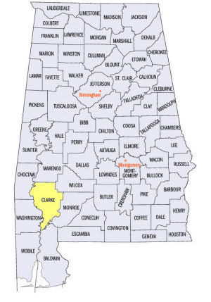
Clarke County Location
View Larger Map
The map to the right shows the location of Clarke County within the State of Alabama.
Clarke County is located in southwestern Alabama within the East Gulf Coastal Plain physiographic region. The Alabama River runs along the eastern edge of the county and the Tombigbee River runs along the western edge of the county. The two meet at the southern end of the county to form the Mobile River.
Clarke County was established by the Mississippi Territory Legislature on December 10, 1812,
The county was named for John Clarke, a general in the Georgia militia, state representative, Indian agent, and Governor of Georgia.
Clarksville was established as the county seat in 1820. The county seat was moved to Grove Hill, located in the central part of the county, in 1831 where it still resides.
University of Alabama
Cartographic Research Lab
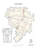
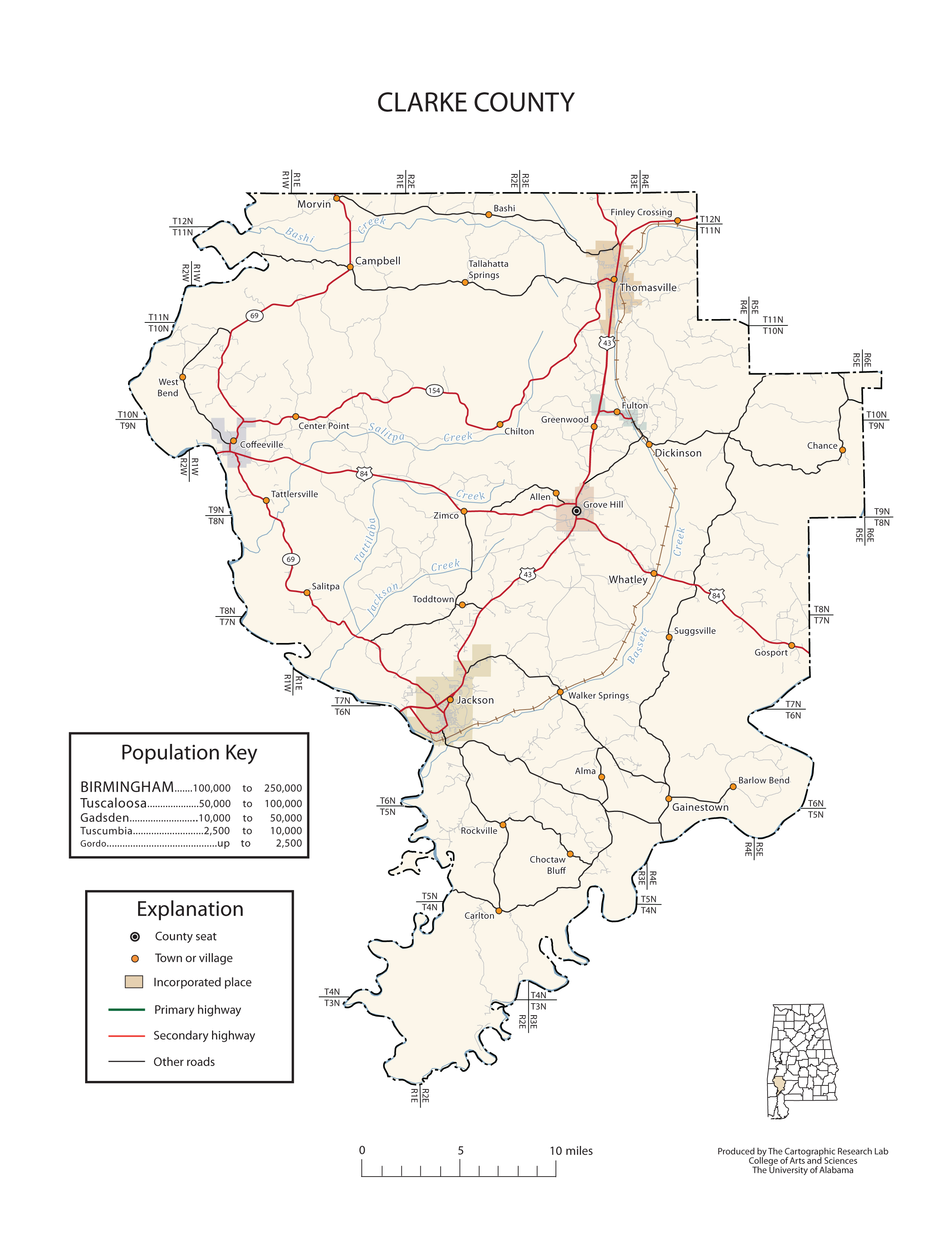
Major roads and towns
Clarke County Map

Sources...
"Alabama Counties: Clarke County." Alabama Department of Archives and History. State of Alabama, 14 Dec 2011. Web. 19 Jan 2014. <http://www.archives.state.al.us/counties/LOWERCASECOUNTYNAME.html>.
Morton, Patricia Hoskins. "Alabama Counties: Clarke County." Encyclopedia of Alabama. Alabama Humanities Foundation, 23 May 2013. Web. 19 Jan 2014. <http://www.encyclopediaofalabama.org/face/Article.jsp?id=h-1073>.
"State & County QuickFacts." United States Census Bureau. United States Department of Commerce. Web. 3 Jan 2014.
Additional Information
Clarke County history page: Alabama Department of Archives and History.
Autauga County: The Encyclopedia of Alabama TM & © 2013. Alabama Humanities Foundation. All Rights Reserved. A service of Auburn University, The University of Alabama, and Alabama State Dept. of Education.
Map: Clarke County's major roads and towns.:
Prepared by the Department of Geography, College of Arts and Sciences, The University of Alabama.
General Highway Map: Clarke County, Alabama:
Prepared by the Alabama Department of Transportation, Bureau of Transportation Planning, Surveying and Mapping Division in cooperation with the U.S. Department of Transportation.
Clarke County, Alabama Genealogical Information: The USGenWeb Project: Keeping Internet Genealogy Free.
Autauga County, Alabama: United States Census Bureau: State & County QuickFacts.
Clark County, Alabama: Official website of Autauga County, Alabama.
Grove Hill: The Encyclopedia of Alabama TM & © 2013. Alabama Humanities Foundation. All Rights Reserved. A service of Auburn University, The University of Alabama, and Alabama State Dept. of Education.
Grove Hill, Alabama: Official Site of the City of Grove Hill, heart of the timber belt.
Alabama County Web Sites: State of Alabama: Alabama Directory.
Alabama County Selection Map: United States Census Bureau: State & County QuickFacts.
Alabama County Map with County Seat Cities: Geology.com.
Maps of Alabama Counties: University of Alabama: Alabama Maps.
Alabama Counties from Amazon.com
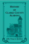
History of
Clarke County, Alabama
John S. Graham
History of Clarke County, Alabama, by John S. Graham. 378 pages. Publisher: Heritage Books, Inc. (September 1, 2012)
This county, situated between the Alabama and Tombigbee Rivers, was initially carved from Washington County in 1812. When Alabama became a territory in 1817, Clarke County was substantially enlarged. This history is rather typical of the genre, and covers all the usual topics. It is especially rich in biographical sketches of residents, and has the usual lists of soldiers and civic officers.
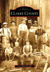
Images of America
Clarke County
Joyce Burrage
Images of America: Clarke County, by Joyce Burrage. 128 pages. Publisher: Arcadia Publishing (November 24, 1998)
Clarke County is a beautifully wooded and peaceful spot in west Alabama with a long and rich history. Bounded on the east by the Alabama River and on the west by the Tombigbee River, Clarke County’s rich timberlands serve as the source for pine timber markets throughout the world. The fantastic hunting and fishing in the county are known throughout the South. Clarke County’s history includes the story of the Mitcham War, a period of unrest in 1893 that reached state-wide proportions in notoriety. The county’s history is one largely comprised of the working men and women who have contributed to the cultural tapestry of the area. This visual journey begins around the time of the earliest woodcut of the courthouse in Grove Hill, built in 1832, and continues through the 1940s. Many of the images in this collection have never before been published. These fascinating glimpses into Clarke County’s past are combined with a well-researched text to uncover many long-forgotten stories and a colorful cast of characters.
Alabama's Mitcham Wars
Jerry Elijah Brown
Alabama's Mitcham Wars, by Jerry Elijah Brown. 267 pages. Publisher: Looking Glass Books (July 11, 2011)
An 1890s murder cold case. . .an account of a bloody episode that left 10 people dead. . .and a grandson s discovery of his grandfather s role in the final slaying all these are threads in Jerry Elijah Brown s true story of conflict and change in a backwoods district of southwest Alabama.
Alabama's Mitcham Wars addressed the tensions between the backcountry farmers who borrowed money to put in their cotton crops and merchant-lenders who took advantage of the crop-lien system. The tensions erupted into what came to be called the Mitcham War, which pitted a gang of local ruffians against a mob of equally lawless vigilantes. The vigilantes made no distinction between the outlaws in the community and terrorized innocent neighbors. The violence resulted in the district s being described in one state paper as Clarke County s criminal colony. Forty years after his grandfather died, the author discovered that Lee Brown had been arrested, jailed, and tried for the assassination of a mysterious detective who assisted the vigilantes.


