
HOME
INTRO
SYMBOLS
ALMANAC
ECONOMY
GEOGRAPHY
STATE MAPS
PEOPLE
COUNTIES
GOVERNMENT
FORUM
NEWS
COOL SCHOOLS
STATE QUIZ
STATE LINKS
BOOK STORE
MARKETPLACE
NETSTATE.STORE
NETSTATE.MALL
GUESTBOOK
CONTACT US


Tweet
Double click on word for definition.
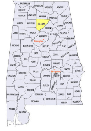
Cullman County Location
View Larger Map
The map to the right shows the location of Cullman County within the State of Alabama.
Cullman County is located in north-central Alabama within the Cumberland Plateau physiographic region. The Mulberry Fork of the Black Warrior River runs along the southeastern edge of the county.
Created from pieces of Blount, Walker, Morgan, and Winston counties, Cullman County was established by an Act of the Alabama Legislature on January 24, 1877.
The county was named for Bavarian Colonel Johann Gottfried Cullman, who purchased large amounts of land, promoted the area and recruited German settlers to the area.
The city of Cullman, founded in 1873 by Johann Cullmann, serves as the county seat of Cullman County.
University of Alabama
Cartographic Research Lab
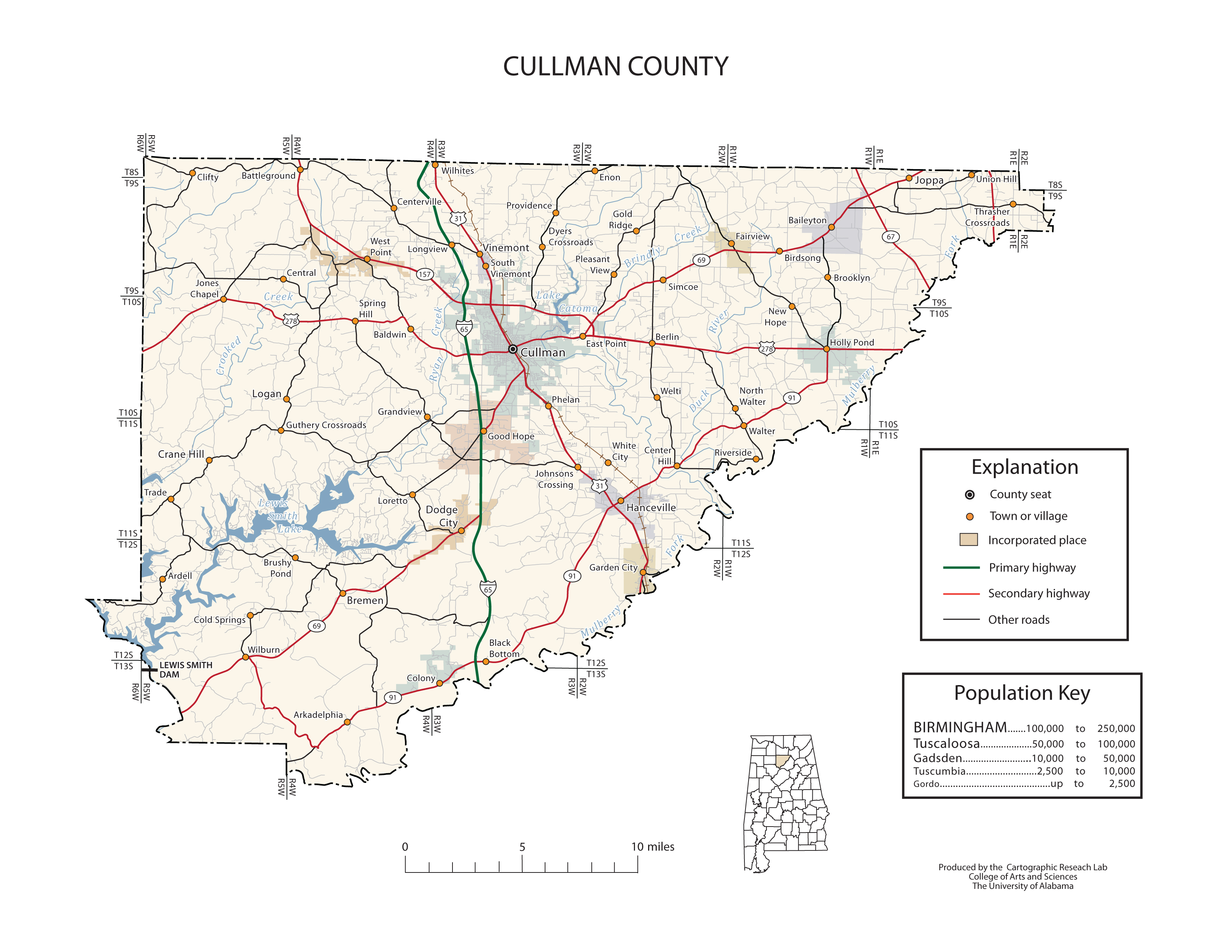
Major roads and towns
Cullman County Map

At a glance
| Category | Information |
|---|---|
| Established: | January 24, 1877 |
| Source: | Created from a parts of Blount, Walker, Morgan, and Winston counties. |
| Area (square miles): | 735 |
| Population (2010 census): | 80,406 |
| Major waterway(s): | The Mulberry Fork, one of three major waterways that join to form the Black Warrior River rises in northeastern Cullman County and travels south to run along the southeastern edge of the county. In 1961, a dam, straddling Jasper and southeastern Cullman counties, was built on the Sipsey Fork. The Lewis Smith Dam formed Lewis Smith Lake, spreading over Cullman, Walker, and Winston counties. |
| Major highway(s): | Interstate 65, the county's major tranportation route, runs north to south through the center of the county. U.S. Route 31 runs north to south beside Interstate 65, while U.S. Route 278 runs east to west in the northern part of Cullman County. |
| County seat: | Cullman |
| Largest city: | Cullman |
Sources...
"Alabama Counties: Cullman County." Alabama Department of Archives and History. State of Alabama, 14 Dec 2011. Web. 22 Jan 2014. <http://www.archives.state.al.us/counties/cullman.html>.
Morton, Patricia Hoskins. "Alabama Counties: Cullman County." Encyclopedia of Alabama. Alabama Humanities Foundation, 3 Apr 2013. Web. 22 Jan 2014. <http://www.encyclopediaofalabama.org/face/Article.jsp?id=h-1326>.
"State & County QuickFacts." United States Census Bureau. United States Department of Commerce. Web. 3 Jan 2014.
Additional Information
Cullman County history page: Alabama Department of Archives and History.
Cullman County: The Encyclopedia of Alabama TM & © 2013. Alabama Humanities Foundation. All Rights Reserved. A service of Auburn University, The University of Alabama, and Alabama State Dept. of Education.
Map: Cullman County's major roads and towns.:
Prepared by the Department of Geography, College of Arts and Sciences, The University of Alabama.
General Highway Map: Cullman County, Alabama:
Prepared by the Alabama Department of Transportation, Bureau of Transportation Planning, Surveying and Mapping Division in cooperation with the U.S. Department of Transportation.
Cullman County, Alabama Genealogical Information: The USGenWeb Project: Keeping Internet Genealogy Free.
Cullman County, Alabama: United States Census Bureau: State & County QuickFacts.
Cullman County: National Association of Counties (NACO).
Cullman County: Home: Official website of Cullman County, Alabama.
Cullman: The Encyclopedia of Alabama TM & © 2013. Alabama Humanities Foundation. All Rights Reserved. A service of Auburn University, The University of Alabama, and Alabama State Dept. of Education.
Cullman, Alabama: Official Site of the City of Cullman, a city of character.
Alabama County Web Sites: State of Alabama: Alabama Directory.
Alabama County Selection Map: United States Census Bureau: State & County QuickFacts.
Alabama County Map with County Seat Cities: Geology.com.
Maps of Alabama Counties: University of Alabama: Alabama Maps.
Alabama Counties from Amazon.com

Images of America:
Cullman
Melanie K. Patterson
Images of America: Cullman, by Melanie K. Patterson. 128 pages. Publisher: Arcadia Publishing (April 15, 2013)
Although German immigrants were not the first to settle in the area now known as Cullman, they are the ones who put the city on the map by incorporating the town in 1874. The original five families that Col. John G. Cullmann recruited to colonize the town quickly grew into many more. With the assistance of local people, the Germans adapted to their new environment, and the colony took root. The strong German heritage and influence is still widespread today. Cullman was, and still is, an agricultural town. Immigrants discovered that cotton, sweet potatoes, and strawberries would readily grow in the area, and they wasted no time in filling the earth with these and other crops. Cullman also thrived on other industry, including numerous factories and merchants. The railroad running through the town played no small part in both the colonization and success of Cullman.


