
| Suggest a link | |
| Report broken link |


South Dakota Base and Elevation Maps
The two maps shown here are digital base and elevation maps of South Dakota. Higher resolution maps like
these and many other digital maps, wall maps, custom radius maps, travel maps, travel guides, map software, and globes and
games, for business and the classroom, are available to purchase from
Maps.com - The World's Largest Maps Store!.
Enter code "NETSTATE" at checkout for 10% off orders of $50 or more!
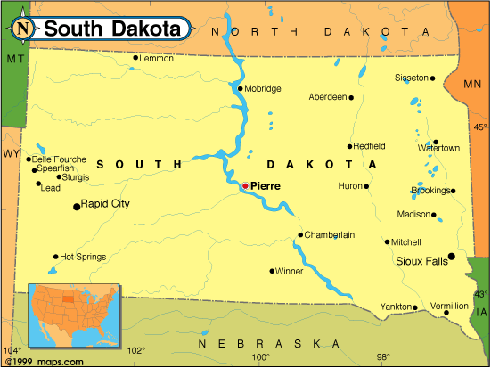 |
This South Dakota base map highlights the location of the state capitol, Pierre, and major cities throughout the state. Portions of South Dakota's border states, North Dakota, Minnesota, Iowa, Nebraska, Wyoming, and Montana are included to show the relationship between South Dakota and its neighbors. A small inset shows South Dakota among the other 47 Continental United States. |
| South Dakota base map, Courtesy of Maps.com. |
|
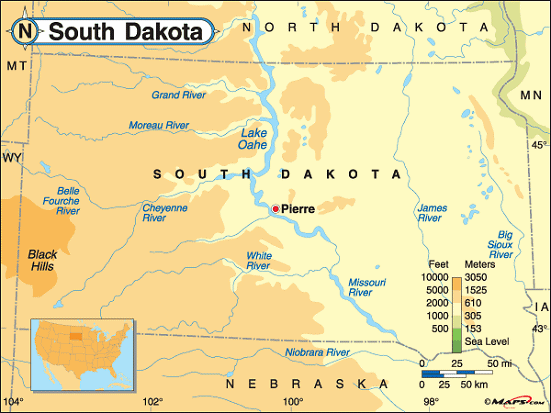 |
This elevation map of South Dakota illustrates the number of feet or meters the
state rises above sea level.
The lowest point in South Dakota is at Big Stone Lake; 966 feet above sea level. The highest point in South Dakota is located in Pennington County in the Black Hills of the southwestern part of the state. About 10 miles northeast of Custer, Harney Peak rises 7,242 feet above sea level. It's located in the Black Elk Wilderness, within the Norbeck Wildlife Preserve in Black Hills National Forest. [ Topographic Map ] |
| South Dakota elevation map, Courtesy of Maps.com. |
Additional information
South Dakota maps: Additional maps and map links from NETSTATE.COM.
South Dakota geography: More South Dakota geography from NETSTATE.COM.
Purchase South Dakota maps:
Maps.com - The World's Largest Maps Store!
- Select map type by clicking on "category" to left on destination page.
- Use code NETSTATE at the checkout for 10% off orders of $50 or more!
- Over 6,000 products to choose from!
Site designed exclusively for NETSTATE.COM by NSTATE, LLC

NETSTATE.COM is a Trademark of NSTATE, LLC.
Copyright © © by NSTATE, LLC. All rights reserved.
No copyright is claimed on non-original or licensed material.
Support NETSTATE