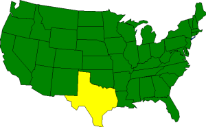

The Geography of Texas
Click here for a few definitions.
| Longitude / Latitude |
Longitude: 93° 31' W to 106° 38' W
Latitude: 25° 50' N to 36° 30' N |
|
| Length x Width |
Texas is 790 miles long and 660 miles wide at its most distant points. |
|
Geographic Center
Explanation |
The
geographic center
of Texas is located in McCulloch County, 15 miles NE of Brady.
Longitude: 99° 27.5'W
Latitude: 31° 14.6'N |
|
| Borders |
Texas is bordered by New Mexico,
Oklahoma, and
Arkansas to the north. On the west Texas is bordered by
New Mexico and shares an international border with Mexico. To the south, Texas borders
Mexico and the Gulf of Mexico. The irregular shape of Texas means that it shares its eastern borders
with Oklahoma, Arkansas, and Louisiana. |
| Total Area |
Texas covers 268,601 square miles, making it the 2nd largest of the
50 states, right behind Alaska. |
| Land Area |
261,914 square miles of Texas are land areas. |
| Water Area |
6,687 square miles of Texas are covered by water making Texas the 9th wettest
state. |
| Highest Point |
The highest point in Texas is Guadalupe Peak at 8,749 feet above sea level. |
| Lowest Point |
The lowest point in Texas is sea level where Texas meets the Gulf of Mexico. |
| Mean Elevation |
The Mean Elevation of the state of Texas is only 1,700 feet above sea level. |
| Major Rivers |
The Rio Grande, which marks the border between Texas and Mexico, The Red River, The Brazos River |
The Land |
| In the south, the Gulf Coast Plain meets the Gulf of Mexico. The North Central Plains slope upward creating
some hills. The Great Plains extend to the Panhandle where they are broken by low mountains, a southern extension
of the Rocky Mountains called Trans-Pecos.
( Texas Close-up ) |
| Climate (All temperatures Fahrenheit) |
| Highest Temperature |
The highest temperature recorded in Texas is 120°, Fahrenheit. This record high
was recorded on August 12, 1936 at Seymour. |
| Lowest Temperature |
The lowest temperature measured in Texas was -23 degrees, recorded on February 8, 1933 at Seminole. |
| Average Temperature |
Monthly average temperatures range from a high of 98.5 degrees to a low of 21.7 degrees. |
| Climate |
Average yearly precipitation for Texas, from 1971 to 2000, is shown on
this chart from Oregon State University. |
|