HOME
INTRO
SYMBOLS
ALMANAC
ECONOMY
GEOGRAPHY
STATE MAPS
PEOPLE
FORUM
NEWS
COOL SCHOOLS
STATE QUIZ
STATE LINKS
BOOK STORE
MARKETPLACE
GUESTBOOK
CONTACT US


Tweet
New Hampshire and United States Maps
NOTE: All maps will be displayed in a new browser window.
Outline maps
Counties U.S. Bureau of the Census 1990
Counties U.S. Bureau of the Census Shaded
Physical feature maps
Rivers and Lakes : National Atlas
New Hampshire natural landmarks: Encyclopedia Britannica
New England shaded relief map:
Ray Sterner's Color Landform Map
Ray Sterner's Color Landform Map with Counties
Ray Sterner's Black & White Landform Map
Climate maps
N.H. Precipitation : National Atlas
Reference maps
Original scale 1:2,500,000 USGS 1972 ltd update 1990
New Hampshire cities: Encyclopedia Britannica
New Hampshire counties: Encyclopedia Britannica
Basic Reference Map : National Atlas
Counties : National Atlas
Counties, Selected Cities/Towns : National Atlas
N.H. Congressional Districts : National Atlas
Congressional District 1 : National Atlas
Congressional District 2 : National Atlas
Federal Lands : National Atlas
Cities: National Geographic Xpeditions Atlas
Cities : National Geographic Xpeditions Atlas
Transportation maps
Traffic reports: Dept. of Transportation
Recreation maps
Tourism region: Great North Woods
Tourism region: White Mountains
Tourism region: Monadnock Region
Tourism region: Merrimack Valley
Tourism region: Dartmouth / Lake Sunapee
United States maps
Basic United States Map - Color, Lines Only
Basic United States Map - Lines Only
United States - State Lines Only
United States - Zoom In, State Lines Only
States and Capitals of the United States
United States Major Cities - Zoom In
Territorial Aquisitions : National Atlas
Time Zones : National Atlas
Satellite View : National Atlas
CIESIN Demographic Data Viewer
Electoral College Votes of the United States
Fun and games
Additional Information

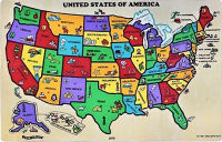
USA Map (Capitals, symbols)
Puzzibilities L4 USA Map (Capitals, symbols), Each colorful wooden puzzle piece of this puzzle is decorated with symbols representative of its state. The Fun Facts Guide lists each state's capital, nickname, bird, motto, and flower.

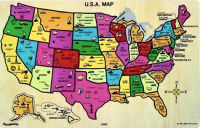
USA Map (Cities, resources, industries)
Puzzibilities L4 USA Map (Cities, resources, industries), Each puzzle piece of this puzzle is a different state, with that state's major cities, resources and industries labeled on the front, Kids can quiz themselves on state capitals by guessing the capital and then removing the puzzle piece for the answer.

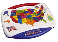
USA Talking Puzzle
USA Talking Puzzle, Geography comes to life in this jumbo-sized floor puzzle, featuring 51 shape-cut pieces of the states. Heavy-grade cardboard pieces are coated on both sides for added durability. Kids will have fun learning the states on this colorful, informative map puzzle. Manufacturer Recommended Age: 6 years and up.

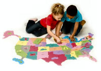
Giant USA Map Puzzle
Giant USA Map Puzzle, Learn geography the entertaining and interactive way with this 2-sided, giant foam puzzle. Includes all 50 states plus 16 punch-out landmarks and 5 great lakes. Teaches recognition by size and shape, and notes the state capital on the back of each piece. Includes fun-facts activity guide.
New Hampshire Atlas and Gazetteer, by Delorme. 80 pages. DeLorme Publishing; 15th edition (September 1, 2005) The first choice of outdoors enthusiasts. Beautiful, detailed, large-format maps of every state. Perfect for home and office reference, and a must for all your vehicles. Gazetteer information may include: campgrounds, attractions, historic sites & museums, recreation areas, trails, freshwater fishing site & boat launches, canoe trips or scenic drives. Categories vary by state .


