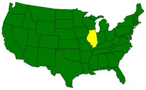
The Geography of Illinois
Click here for a few definitions.
| Longitude / Latitude |
Longitude: 87° 30' W to 91° 30' W
Latitude: 36° 58' N to 42° 30' N |
|
| Length x Width |
Illinois is 390 miles long and 210 miles wide. |
|
Geographic Center
Explanation |
Near the geographic center of Illinois is a small village in Logan County called
Chestnut.
Chestnut is located between
Lincoln and
Decatur about 28 miles northeast of
Springfield.
Longitude: 89° 18.4'W
Latitude: 40° 0.8'N |
|
| Borders |
Illinois is bordered by Wisconsin on the north and
Kentucky in the south.
On the east, Illinois is bordered by Lake Michigan and Indiana.
Illinois borders Iowa and Missouri
on the west. |
| Total Area |
Illinois covers 57,918 square miles, making it the 25th largest of the
50 states. |
| Land Area |
55,593 square miles of Illinois are land areas. |
| Water Area |
2,325 square miles of Illinois are covered by water. |
| Highest Point |
The highest point in Illinois is Charles Mound at 1,235 feet above
sea level. |
| Lowest Point |
The lowest point in Illinois is on the Mississippi River; 279 feet
above sea level. |
| Mean Elevation |
The Mean Elevation of the state of Illinois is 600 feet above sea level. |
| Major Rivers |
Illinois River,
Mississippi River,
Ohio River,
Wabash River |
| Major Lakes |
Lake Michigan,
Rend Lake |
The Land |
| Bordered by the Mississippi River on the west and the Wabash and Ohio Rivers on the southeast and south,
the landscape of Illinois can be grouped into three main regions; the Central Plains, the Shawnee Hills and the
Gulf Coastal Plain.
The Central Plains: About 90% of Illinois is covered by the Central Plains region. These gently
rolling fertile plains were carved and leveled by glaciers during the Ice Age. The Central Plains
run from Lake Michigan west and south to cover most of the state and can be divided into three sections;
the Great Lakes Plain, the Driftless Plains and the Till Plains.
- The Great Lakes Plains This low flat stretch of land along
Lake Michigan develops
some small hills north and west of Chicago.
- The Driftless Plains In the northwest corner of Illinois, the Driftless Plains offer the
highest elevations in the state. Large hills and valleys are present in this small area of
Driftless Plains. This is where Charles Mound, the highest point in Illinois, is located.
- The Till Plains By far the largest section of the Central Plains, the Till Plains offers
Illinois' contribution to the
Corn Belt. This area of
fertile soil typifies the landscape that helped make Illinois one of the top five corn producing states,
one of the leading agricultural states in the nation and gave Illinois one of its nicknames; The Prairie
State. Some call the Till Plains section of Illinois the Garden Spot of the Nation.
The Shawnee Hills: The Shawnee
Hills region stretches across the southern part of Illinois south
of the Central Plains. This small strip of land, ranging from five to 40 miles wide and about 70 miles
long is characterized by higher elevations (300 to 1,065 feet). The landscape of the
Shawnee Hills consists of
rivers, valleys and woodland.
The Gulf Coastal: The extreme southern tip of Illinois is covered by the northern reach of the
Gulf Coastal Plain that stretches north from the Gulf of Mexico. This is the land between the Ohio River
on the east and the Mississippi River on the west and sometimes referred to as
"Egypt" because
of its resemblance to the Nile Delta. Just south of the Shawnee Hills, the Gulf Coastal Plain
tends to be hilly but flattens significantly toward the Illinois border with Kentucky.
( Illinois Close-up ) |
| Climate (All temperatures Fahrenheit) |
| Highest Temperature |
The highest temperature recorded in Illinois is 117°, Fahrenheit. This record high
was recorded on July 14, 1954 at East St. Louis. |
| Lowest Temperature |
The lowest temperature in Illinois, -36°, was recorded on January 5, 1999 at Congerville. |
| Average Temperature |
Monthly average temperatures range from a high of 87.1 degrees to a low of 9.8 degrees. |
| Climate |
Average yearly precipitation for Illinois, from 1971 to 2000, is shown on
this chart from Oregon State University. |
|
Sources:
The World Almanac of the U.S.A. by Allan Carpenter and Carl Provorse, Copyright © 1998
Robert McColley and William D. Walters, Jr., "Illinois," World Book Online Americas Edition, http://www.worldbookonline.com/wbol/wbPage/na/ar/co/272380, August 14, 2001.
The United States Geological Survey Website
Maps.com http://www.maps.com http://www.maps.com |
|