
| Suggest a link | |
| Report broken link |


California Base and Elevation Maps
The two maps shown here are digital base and elevation maps of California. Higher resolution maps like
these and many other digital maps, wall maps, custom radius maps, travel maps, travel guides, map software, and globes and
games, for business and the classroom, are available to purchase from
Maps.com - The World's Largest Maps Store!.
Enter code "NETSTATE" at checkout for 10% off orders of $50 or more!
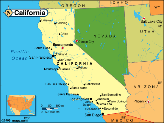 |
This California base map highlights the location of the state capitol, Sacramento, and other major cities throughout the state. Portions of California's border states, Oregon, Nevada, and Arizona are included to show the relationship between California and its neighbors. California's entire western coast is bordered by the North Pacific Ocean. A small inset shows California among the other 47 Continental United States. |
| California base map, Courtesy of Maps.com. |
|
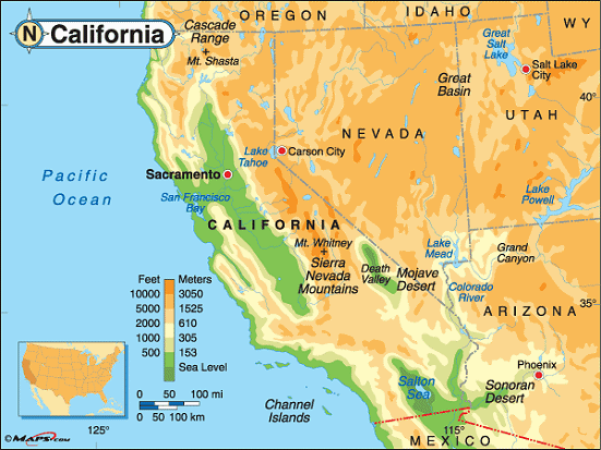
California elevation map, Courtesy of Maps.com. |
This elevation map of California illustrates the number of feet or meters the state rises above sea
level. The large green area that runs north to south in the center of the state is called
the "Central Valley" or "Great Valley".
The lowest point in California is located in the Mojave Desert, in Death Valley, in Inyo County. At 282 feet below sea level, it is the lowest point in the United States. To the east of the Central Valley is the Sierra Nevada Mountain Range. Mount Whitney is located in the Sierra Nevadas, in Inyo and Tulare Counties. It sits on the western edge of Sequoia National Park, about 90 miles southeast of Fresno. Its peak is the highest point in California and the highest point in the 48 Continental States. |
Additional information
California maps: Additional maps and map links from NETSTATE.COM.
California geography: More California geography from NETSTATE.COM.
State elevations: State elevations listed by mean elevation, state high point and state low point.
Purchase California maps:
Maps.com - The World's Largest Maps Store!
- Select map type by clicking on "category" to left on destination page.
- Use code NETSTATE at the checkout for 10% off orders of $50 or more!
- Over 6,000 products to choose from!
Site designed exclusively for NETSTATE.COM by NSTATE, LLC

NETSTATE.COM is a Trademark of NSTATE, LLC.
Copyright © © by NSTATE, LLC. All rights reserved.
No copyright is claimed on non-original or licensed material.
Support NETSTATE