
| Suggest a link | |
| Report broken link |


Florida Base and Elevation Maps
The two maps shown here are digital base and elevation maps of Florida. Higher resolution maps like these and many other digital maps, wall maps, custom radius maps, travel maps, travel guides, map software, and globes and games, for business and the classroom, are available to purchase from Amazon.Com.
Track Hurricane Irma at NYTimes.Com
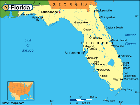 |
This Florida base map highlights the location of the state capitol, Tallahassee, and major cities throughout the state. Portions of Florida's border states, Alabama and Georgia are included to show the relationship between Florida and its neighbors. A small inset shows Florida among the other 47 Continental United States. |
| Florida maps available at Amazon.Com | |
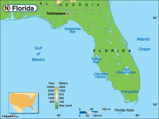 |
This elevation map of Florida illustrates the number of feet or meters the
state rises above sea level.
Britton Hill, in the Florida Panhandle, is the highest point in Florida, at 345 feet above sea level. It's the lowest high point of all the state high points. Britton Hill is located in Walton County, about 1/2 mile south of the Alabama border and about 68 miles northeast of Pensacola. The lowest point in Florida is sea level at the Atlantic Ocean. |
| Florida maps available at Amazon.Com |
Additional information
Florida maps: Additional maps and map links from NETSTATE.COM.
Florida geography: More Florida geography from NETSTATE.COM.
State elevations: State elevations listed by mean elevation, state high point and state low point.
Florida maps available at Amazon.Com
Track Hurricane Irma at NYTimes.Com
Site designed exclusively for NETSTATE.COM by NSTATE, LLC

NETSTATE.COM is a Trademark of NSTATE, LLC.
Copyright © © by NSTATE, LLC. All rights reserved.
No copyright is claimed on non-original or licensed material.
Support NETSTATE