
| Suggest a link | |
| Report broken link |


Virginia Base and Elevation Maps
The two maps shown here are digital base and elevation maps of Virginia.
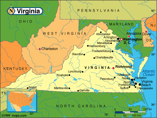 |
This Virginia base map highlights the location of the state capitol,
Richmond, and
major cities throughout the state. Portions of Virginia's border states,
Maryland,
North Carolina,
Tennessee,
Kentucky, and
West Virginia are
included to show the relationship between Virginia and its neighbors. A small inset shows Virginia among the
other 47 Continental United States.
On its east, Virginia is bordered by Chesapeake Bay and the Atlantic Ocean. |
| Virginia base map | |
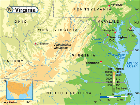 |
This elevation map of Virginia illustrates the number of feet or meters the
state rises above sea level. Virginia's lower elevations and lowest points (sea level) are in the east along the
Chesapeake Bay and the Atlantic Ocean. The land rises to the west where the Blue Ridge Mountains run along
Virginia's western border with West Virginia and Kentucky.
The highest point in Virginia is Mount Rogers, at 5,729 feet above sea level, located in Grayson County in the southwestern part of the state. About 100 miles southwest of Roanoke and 33 miles northeast of Bristol, Mount Rogers is part of the Mount Rogers National Recreational Area. [ Topographic Map ] |
| Virginia elevation map |
Additional information
Virginia maps: Additional maps and map links from NETSTATE.COM.
Virginia geography: More Virginia geography from NETSTATE.COM.
Site designed exclusively for NETSTATE.COM by NSTATE, LLC

NETSTATE.COM is a Trademark of NSTATE, LLC.
Copyright © © by NSTATE, LLC. All rights reserved.
No copyright is claimed on non-original or licensed material.
Support NETSTATE