
| Suggest a link | |
| Report broken link |


Wyoming Base and Elevation Maps
The two maps shown here are digital base and elevation maps of Wyoming.
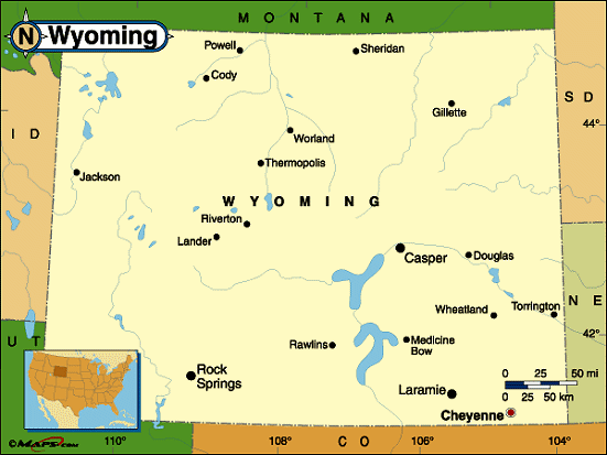 |
This Wyoming base map highlights the location of the state capitol, Cheyenne, and major cities throughout the state. Portions of Wyoming's border states, Montana, South Dakota, Nebraska, Colorado, Utah, and Idaho are included to show the relationship between Wyoming and its neighbors. A small inset shows Wyoming among the other 47 Continental United States. |
| Wyoming base map | |
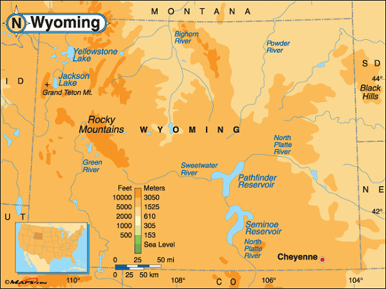 |
This elevation map of Wyoming illustrates the number of feet or meters the
state rises above sea level.
Wyoming has the second highest low point in the United States, behind only Colorado. The state's low point is at the Belle Fourche River (3,099 feet above sea level). The highest point in Wyoming is Gannett Peak, located about 58 miles northwest of Lander. Also the highest point in the Wind River Range in the central Rocky Mountains, the slopes of Gannett Peak lie within Bridger-Teton National Forest and Shoshone National Forest in the west-central part of the state. Gannett Peak reaches a height of 13,804 feet above sea level |
| Wyoming elevation map |
Additional information
Wyoming maps: Additional maps and map links from NETSTATE.COM.
Wyoming geography: More Wyoming geography from NETSTATE.COM.
Site designed exclusively for NETSTATE.COM by NSTATE, LLC

NETSTATE.COM is a Trademark of NSTATE, LLC.
Copyright © © by NSTATE, LLC. All rights reserved.
No copyright is claimed on non-original or licensed material.
Support NETSTATE