
HOME
INTRO
SYMBOLS
ALMANAC
ECONOMY
GEOGRAPHY
STATE MAPS
PEOPLE
COUNTIES
GOVERNMENT
FORUM
NEWS
COOL SCHOOLS
STATE QUIZ
STATE LINKS
BOOK STORE
MARKETPLACE
NETSTATE.STORE
NETSTATE.MALL
GUESTBOOK
CONTACT US


Tweet
Double click on word for definition.
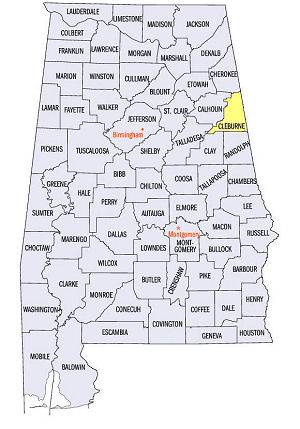
Cleburne County Location
View Larger Map
The map to the right shows the location of Cleburne County within the State of Alabama.
Cleburne County is located in eastern Alabama within the Piedmont Upland physiographic region. Its eastern boundary borders the State of Georgia. In the west, about 1/3 of the county lies within the Talladega National Forest. Mount Cheaha, the highest point in the state, is found in this this part of the Talladega National Forest.
Cleburne County was established by an Act of the Alabama Legislature on December 6, 1866 from parts of Calhoun, Randolph and Talladega counties.
The county was named for Confederate Major General Patrick Ronayne Cleburne. Patrick Cleburne is memorialized in several books, including Craig L. Symonds' Stonewall of the West.
Heflin, located in the south central part of the county, serves as the county seat of Cleburne County.
University of Alabama
Cartographic Research Lab
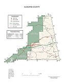
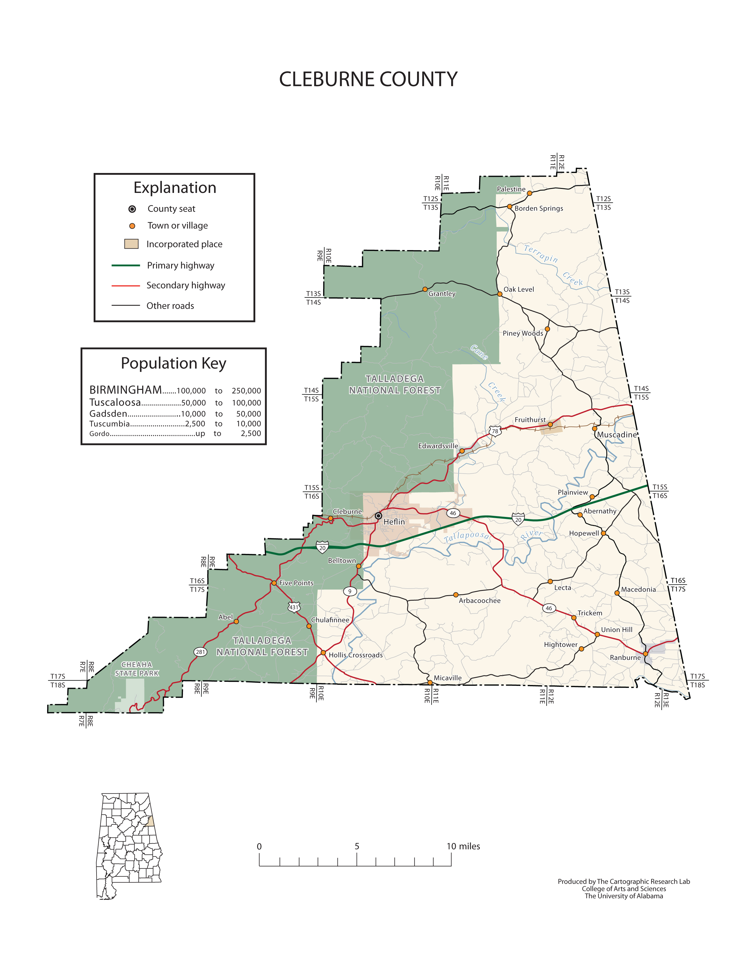
Major roads and towns
Cleburne County Map

Sources...
"Alabama Counties: Cleburne County." Alabama Department of Archives and History. State of Alabama, 19 Nov 2011. Web. 20 Jan 2014. <http://www.archives.state.al.us/counties/cleburne.html>.
Morton, Patricia Hoskins. "Alabama Counties: Cleburne County." Encyclopedia of Alabama. Alabama Humanities Foundation, 9 May 2013. Web. 20 Jan 2014. <http://www.encyclopediaofalabama.org/face/Article.jsp?id=h-1322>.
"State & County QuickFacts." United States Census Bureau. United States Department of Commerce. Web. 3 Jan 2014.
Additional Information
Cleburne County history page: Alabama Department of Archives and History.
Cleburne County: The Encyclopedia of Alabama TM & © 2013. Alabama Humanities Foundation. All Rights Reserved. A service of Auburn University, The University of Alabama, and Alabama State Dept. of Education.
Map: Cleburne County's major roads and towns.:
Prepared by the Department of Geography, College of Arts and Sciences, The University of Alabama.
General Highway Map: Autauga County, Alabama:
Prepared by the Alabama Department of Transportation, Bureau of Transportation Planning, Surveying and Mapping Division in cooperation with the U.S. Department of Transportation.
Cleburne County, Alabama Genealogical Information: The USGenWeb Project: Keeping Internet Genealogy Free.
Cleburne County, Alabama: United States Census Bureau: State & County QuickFacts.
Cleburne County Commission: Official website of Cleburne County Commisssion, Alabama.
Heflin: The Encyclopedia of Alabama TM & © 2013. Alabama Humanities Foundation. All Rights Reserved. A service of Auburn University, The University of Alabama, and Alabama State Dept. of Education.
Heflin, Alabama: Official Site of the City of Heflin, a great place to call home.
Alabama County Web Sites: State of Alabama: Alabama Directory.
Alabama County Selection Map: United States Census Bureau: State & County QuickFacts.
Alabama County Map with County Seat Cities: Geology.com.
Maps of Alabama Counties: University of Alabama: Alabama Maps.
Alabama Counties from Amazon.com
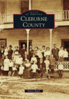
Images of America:
Cleburne County
Wayne Ruple
Images of America, Cleburne County, by Wayne Ruple. 128 pages. Publisher: Arcadia Publishing (November 1, 2010)
Cleburne County is strategically located between the two major cities of Birmingham and Atlanta. Once a part of Benton County, Cleburne County was officially created in 1866 by the Alabama legislature and named in honor of Gen. Patrick R. Cleburne, who served the Confederacy during the Civil War. The Talladega National Forest covers the western half of the county and includes Mount Cheaha, the highest point in the state. Cleburne County gained national notoriety in the 1840s when gold was discovered around Arbacoochee, which became one of the largest mining towns in the state. Over $5 million in gold was mined there. In the early 1900s, the area's mild climate and rich soil drew several hundred settlers from northern states who came to Cleburne County and established a wine-producing colony, Fruithurst, which produced as much as 23,000 gallons per year.


